Geospatial
Unlock the power of geospatial data with our detailed and comprehensive data annotation services for precise mapping and analysis
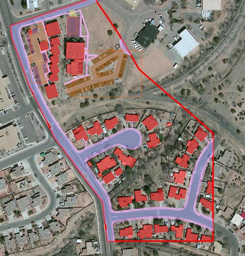
Geospatial Annotation Service
we specialize in providing high-quality data annotation services, including our Geospatial Annotation Service.
Our Geospatial Annotation Service is designed to assist businesses and organizations in accurately labeling and annotating geospatial data. This service involves the careful review and analysis of maps, satellite images, and other forms of geospatial data, in order to identify and label key features such as buildings, roads, bodies of water, and other landmarks.
Our team of experienced data annotation experts utilizes advanced software tools and techniques to ensure that all geospatial data is accurately annotated and labeled, allowing our clients to make more informed decisions based on this information. We also provide customized annotation solutions to meet the unique needs of each client, ensuring that their specific geospatial data annotation needs are met.
At our company, we are committed to providing exceptional data annotation services, including our Geospatial Annotation Service. Whether you need assistance with geospatial data labeling, image annotation, or any other form of data annotation, we are here to help. Contact us today to learn more about our services and how we can help your business succeed.